JUNIA’s Environmental Science program, taught in English or in French, is based on the internationally renowned expertise that JUNIA has gained in sustainable environmental management over the last 15 years. This internationally-accredited program delivers a Master of Science and Engineering, allowing graduates to enter the workforce or pursue doctoral studies in institutions around the world.
Admission level
Bachelor level
Campus
Lille
Diploma
JUNIA ISA
Start date
September
Teaching languages : FR | EN
Course objectives
Environmental science
JUNIA has built its expertise in Environmental Science on:
- Applied courses in soil remediation, waste management, urban planning & environmental engineering
- Research activities in the field of Soil Pollution and Remediation (LGCGE National Lab)
- An international network of partner universities
- Industrial partnerships with global leaders
Program objectives
English taught courses
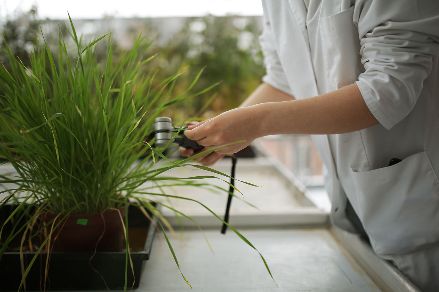
The Environmental Science program is designed to train future managers and scientists through a hands-on approach to gaining technical expertise in the sustainable management of polluted sites in an international context. Students gain skills in:
- Prevention of soil, water and air pollution
- Management and treatment of sites contaminated by human activities
- General assessment of pollution
- Remediation/treatment of polluted sites (bioremediation, phytoremediation, biotechnology, and more)
The program for the 1st semester of the Master 2 depends on the specialisation.
French taught classes
| Master 1 | Courses | ECTS |
|---|---|---|
| Master 1 > Fall semester | Courses Projet en environnement | ECTS 6 |
| Master 1 | Courses Gestion des déchets | ECTS 3 |
| Master 1 | Courses Gestion des eaux | ECTS 6 |
| Master 1 | Courses Management environnemental | ECTS 3 |
| Master 1 | Courses Management de la sécurité des risques industriels | ECTS 3 |
| Master 1 > Spring semester | Courses Smart Cities: Energies renouvelables, écoquartiers, bâtiment durable | ECTS 3 |
| Master 1 | Courses Aménagement du territoire et risques naturels | ECTS 3 |
| Master 1 | Courses Projet en environnement | ECTS 6 |
| Master 1 | Courses Gestion des sites et sols pollués | ECTS 3 |
| Master 1 | Courses Economie des ressources naturelles et de la biodiversité | ECTS 3 |
| Master 1 | Courses Ecologie appliquée | ECTS 6 |
| Master 1 | Courses Droit de l'environnement | ECTS 3 |
| Master 2 | Course | ECTS |
|---|---|---|
| Master 2 > Fall semester | Course Specialization: Management de la Performance Environnementale Globale | ECTS 30 ECTS |
| Master 2 > Spring semester | Course End-of-Study Internship Six-month professional experience Thesis Report + Oral Defense | ECTS 30 ECTS |
International hands-on experience
The Environmental Science program prepares students to be operational professionals even before graduating, thanks to the combined theoretical and practical approach. The teaching methods provide students from various backgrounds and cultures with the operational and managerial skills required in the corporate world. Students learn through Project Based Learning approach, with group work and case studies, field visits where students can see first-hand the jobs they might choose for their future, and industrial projects over the two years of the program. Internships in a company or a laboratory allow students to confront the reality of the professional world and prepare them for their entry into active employment.
In addition, JUNIA is dedicated to giving students a well-rounded and international experience. A number of international experts participate in lectures on various topics over the course of the Master. They come from our partner universities or companies in Brazil, the USA, the Czech Republic, Greece, Italy, The Netherlands, among others. Moreover, students get the chance to attend international conferences in France and abroad and participate in study tours in Europe:
- 2 weeks in the Netherlands to study applied techniques of Bioremediation/Physico-chemical remediation/Thermal remediation in soil and sediment management
- 2-3 weeks of study on Microbial Ecology – Bioremediation Phytoremediation at UCT Prague and USB
Internships
Professional support
As with all programs at JUNIA, students will spend 40% of their studies in internships. These periods of professional immersion, carried out either in France or abroad, in a company or a laboratory, expose students to the reality of the professional world.
Examples of our students' Internships
Careers
Students in the JUNIA Environmental Science program benefit from direct experience with partner companies early in the curriculum. Guest lectures, site visits, study tours, and internship periods mean JUNIA alumni are ready to work well before they graduate.
Environmental Science graduates get diverse jobs and positions in the following departments: R&D, Prevention and Reduction of Pollution and Risks, Management of Polluted Sites. In addition, many of our Environmental Science graduates go on to pursue a PhD, thanks to the hands-on research experience they gain in our laboratories.
Examples of Our Alumni’s Positions
- PhD research on rhizosphere processes leading to nickel uptake by hyperaccumulator plants – University of Queensland, Australia
- Project manager, Management of Polluted Sites – RAMERY, France
- PhD research on Dynamic modelisation of the availability of Cesium in the soil-plant-atmosphere continuum – Institut de Radioprotection et de Surété Nucléaire, France
- Junior Life Cycle Assessment Manager – CYCLeco, France
- PhD research on Characterization of Natural Organic Matter and processes during drinking water treatment – Université Lille 1, France
- Research and Development Engineer; CEBEDEAU, Belgium
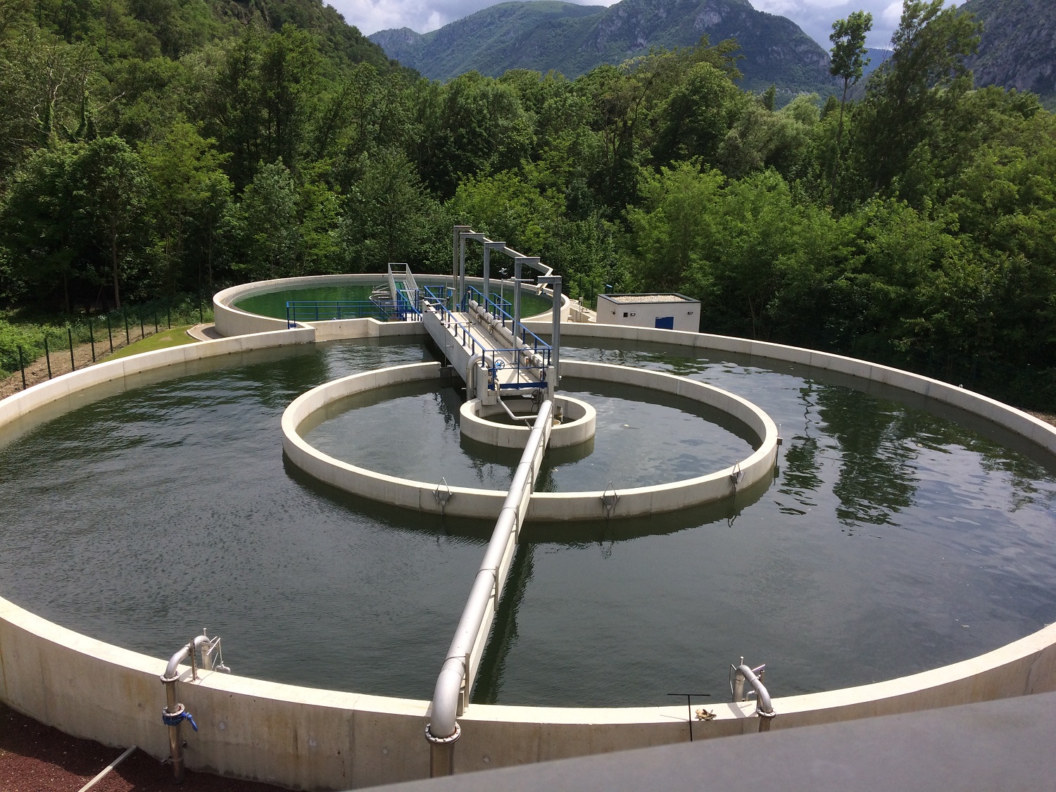
Research in soils & environement
Increasing urbanization, intensive agriculture as well as the industrial past of our region guided the research thematic of the laboratory on the management of soils which are affected at various levels by anthropogenic activities. Scientific and technical arguments have been given to help the conservation and the improvement of soil quality with environmental and healthy preoccupations for many years.

2-year program tuition fees
18 000€
Tuition fees for total program 2023-2025
Tuition fees do NOT include living expenses, accommodation, additional administrative, equipment or organizational fees relating to particular programs.
Admission
Prerequisites
Learn more about the admission process
- Minimum Bachelor degree in Life Sciences (Environmental Science, Biology, Chemistry or related field)
- English B2 level certified by an official test (IELTS, TOEIC, TOEFL IBT or FIRST), except students from countries where English is an official language
- French is NOT required for admission to English-taught programs, but is highly recommended
You must bring your own computer when you arrive at JUNIA as we do not have computers to borrow.
Accreditations
A recognized diploma
The Sustainable Mangement of Pollution Master Program prepares students to obtain the JUNIA ISA engineering degree.
The engineering degree awarded after 2 years of study is recognized by the State and accredited by both the Institut National des Sciences Appliquées Hauts-de-France (INSA) and the Université Polytechnique Hauts-de-France (UPHF).
JUNIA is a non-profit association, with EESPIG certification. The EESPIG qualification distinguishes us from other private establishments, as an establishment recognized as being of general interest (participation in public service missions and disinterested management of our activities). In other words: the only profit sought is that of our students in their development within their training and the development of their professional project.
Parnters and certifications
Download our brochures
To learn more about the academics and degree offer at JUNIA, request our brochures.
Our team
Contacts
You may also be interested in :